Don't Get Cited: A No-BS Guide to Utah's Fishing and Climbing Permit Maze
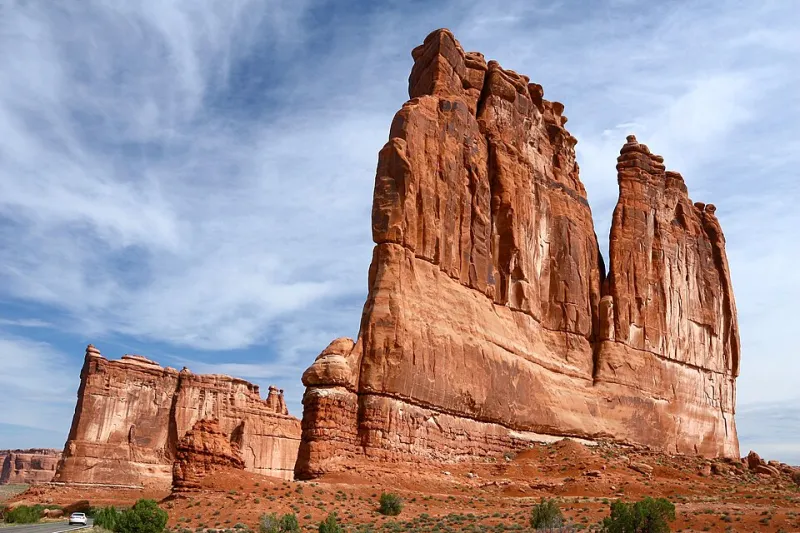
Photo: Sanjay Acharya, CC BY-SA 3.0, via Wikimedia Commons
You've done the hard part. You've scouted the route, tied your leaders, loaded the truck, and mapped out a week in some of the most spectacular terrain on the planet. Then you pull up to a trailhead and realize you're missing a piece of paper—or worse, you find out after the fact when a ranger hands you a fine.
Utah is genuinely one of the best places in the country to fish and climb. But the regulatory landscape? It's a patchwork quilt stitched together by the Utah Division of Wildlife Resources, the Bureau of Land Management, the U.S. Forest Service, the National Park Service, and in some cases, private landowners who hold water or wall access. Each agency plays by its own rulebook. Overlap is common. Confusion is almost guaranteed if you haven't done your homework.
This guide won't make the system less complicated—but it will make sure you're not the person standing at the water's edge wondering if your license actually covers this stretch of river.
Start Here: The License Is Just the Beginning
Every angler in Utah aged 12 and older needs a valid Utah fishing license. That's the baseline, and most people know it. What surprises folks is everything stacked on top of that baseline.
Certain species require additional stamps or endorsements. Chasing a trophy trout on a Blue Ribbon fishery? Some of those waters carry special regulations—slot limits, catch-and-release-only sections, gear restrictions (single barbless hooks, artificial lures only), or reduced bag limits. The Green River below Flaming Gorge is a classic example. It's one of the most productive trout fisheries in the West, and it also has some of the most specific rules on the books. Ignoring the fine print there is a fast way to ruin a great trip.
Walleye, bass, and warm-water species come with their own set of regulations that shift by water body. Lake Powell, Jordanelle, Starvation, Strawberry—each has individual rules around season dates, size limits, and sometimes even the type of watercraft you can use. Always pull the Utah DWR regulation booklet for the specific body of water you're targeting, not just the general statewide summary.
When Public Land Gets Complicated
Here's where it gets layered. A lot of Utah's best fishing and climbing happens on public land—which sounds simple until you realize that "public land" in Utah is administered by at least four different federal agencies, each with its own permit structure.
National Parks (think Zion, Arches, Canyonlands) require entrance fees and, for climbing, often require a separate backcountry permit if your route involves overnight stays. Zion's permit system for popular routes like Angels Landing is now a lottery. Canyonlands has permit requirements for technical canyoneering that overlap with climbing access in ways that aren't always obvious from the trailhead sign.
BLM land is generally more permissive, but don't mistake "more permissive" for "no rules." Popular climbing areas like Indian Creek operate under a Leave No Trace framework with informal but enforced camping limits. Some BLM areas near sensitive archaeological sites have restricted access zones that aren't well-marked. The Fisher Towers area near Moab is a good example—beautiful, accessible, and regularly patrolled.
National Forests (Uinta-Wasatch-Cache, Manti-La Sal, Dixie) often require fire permits for backcountry camping, and some high-use areas have instituted overnight parking permits or campsite reservation systems. If you're building a base camp for a week of high-alpine fishing in the Uintas, check current forest closure orders before you go—fire season can change access overnight.
Private Land: The Invisible Wall
This one catches people more than any other. Utah has a lot of private land that borders or even surrounds public access points. Water rights in Utah are complex, and the "public access to navigable waterways" rules that apply in some states don't always translate cleanly here.
If you're planning to wade a stretch of river, make sure you know where the property boundaries are. Trespassing citations on private fishing land are real, and "I didn't see a sign" is not a legal defense. The Utah Stream Access Coalition has done a lot of work to clarify public vs. private access on key waterways, and their resources are worth bookmarking before any river trip.
For climbing, private wall access is often managed through informal agreements between landowners and climbing organizations like the Access Fund or local clubs. Before heading to a crag you found on Mountain Project, check whether that access is current. Landowner relationships can change, and access that was open last season may be closed this one.
Common Mistakes That Get People Cited
Let's be direct about the stuff that actually lands people in trouble:
- Fishing without a license loaded on your phone or printed. Digital licenses are valid in Utah, but rangers do check. Don't assume your purchase went through without confirming.
- Ignoring water-specific regulations. Statewide rules are a starting point, not the full picture.
- Camping in restricted zones. Many popular climbing areas have designated camping areas only. Dispersed camping outside those zones can result in fines.
- Building fires during fire restrictions. Even a small camp stove can be restricted during high-fire conditions. Check current restrictions at campfire permits are issued through USFS or BLM local offices.
- Accessing water through private land. Even if the water itself is public access, the path to get there may not be.
- Assuming last year's permit is still valid. Lottery systems, seasonal permits, and access agreements reset. Verify every year.
Quick-Reference Checklist Before You Go
Print this or screenshot it. Seriously.
For Anglers:
- Valid Utah fishing license (and any required stamps or endorsements)
- Water-specific regulations pulled from DWR for your target water
- Confirmed public vs. private access for wading sections
- Current fire and camping restrictions for the area
- Watercraft registration if applicable
For Climbers:
- Entrance fee or pass for National Parks (America the Beautiful Annual Pass covers most)
- Backcountry permit if overnight on NPS land
- Current access status checked via Access Fund or local climbing coalition
- Fire and camping restrictions for BLM or Forest Service land
- Parking permit if required (increasingly common at high-use trailheads)
For Both:
- Leave No Trace plan in place
- Emergency contact filed with someone at home
- Cell coverage gaps mapped out (most backcountry Utah has none)
Where to Look It Up
The Utah DWR website (wildlife.utah.gov) is the authoritative source for fishing licenses and regulations. For public land access, Recreation.gov handles most federal permit reservations. The Access Fund (accessfund.org) tracks climbing-specific access issues nationally with Utah well-represented. And for real-time fire and closure information, check with the relevant BLM field office or Forest Service ranger district—those updates don't always make it to the main agency websites quickly.
The system is imperfect. It's built by multiple agencies with overlapping jurisdictions and it changes frequently. But a couple hours of research before you leave the house is a lot cheaper than a citation and a lot less frustrating than getting turned back at the trailhead. Do the work upfront and spend your time where it belongs—on the water or on the wall.